
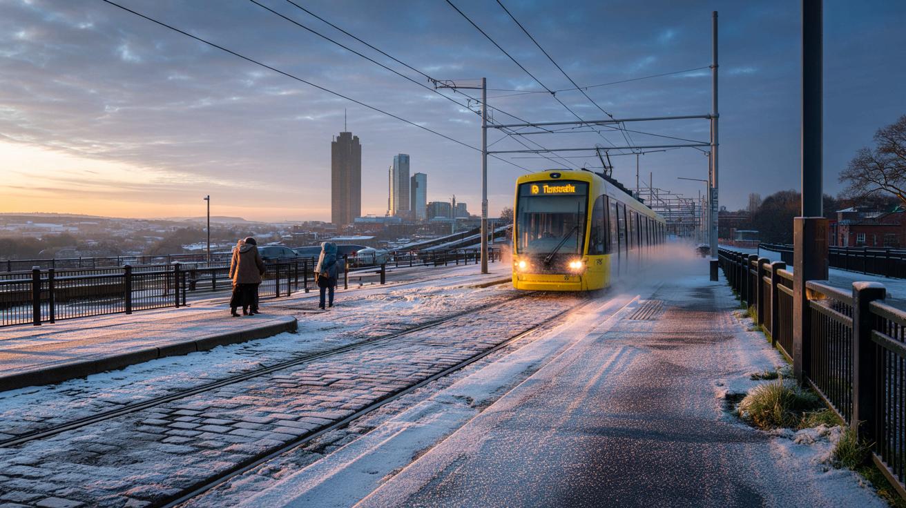
A colder snap is brewing for Greater Manchester, with a dawn twist.
After days of heavy rain and gusty winds, the North West faces a very different week ahead. Parts of Greater Manchester could wake to wintry weather as temperatures tumble across the region. The Met Office has signalled « drier and colder conditions » moving in, with a chance of frost, wintry showers and some snow in places. The focus now shifts from flooding concerns to icy mornings.
On Thursday 20 November, forecasters say the mercury could dip to below freezing, potentially down to -2C in parts of North West England. BBC Weather indicates light snow is likely in several boroughs during the early hours, most commonly between 6am and 8am, before a turn to sleet. Later, sunny intervals are expected with daytime highs near 5C and lows around 1C. So who gets the white wake up?
Met Office signals a colder, drier turn with frost on the cards
The Met Office says it will become « noticeably colder everywhere » next week, regardless of whether snow lands. Northern and eastern areas are set to feel the brunt, thanks to a « brisk northerly wind ». That set-up tends to feed in colder air and leave exposed coasts prone to showers, sometimes wintry over higher ground.
Its long-range forecast, covering Sunday 16 November to 25 November, states: « Central and northern parts of the UK will likely be in a colder but drier regime than of late with overnight frost, and some showers near windward coasts in particular which may be wintry on high ground in the north. »
The Met Office adds: « However, across the south it is likely to be cloudier and wetter initially, with some uncertainty as to how quickly this clears away to the south. It is most likely that the bulk of the UK will experience drier and colder conditions into the first part of next week. »
And later, there is a note of caution: « Later in the period there is increasing uncertainty, but a trend towards more changeable conditions is possible, with some rain or showers in places, and perhaps some hill snow at times in the north. Temperatures overall may return to near average. »
Where and when snow could fall in Greater Manchester
Forecast models suggest a short window of light snow for some boroughs in the early hours, sliding to sleet as the morning commute gets going. Then a brighter picture emerges for many, though cold air will linger. And yes, conditions could still change as the week draws closer.
- Bolton – light snow between 1am and 4am, turning to sleet from 10-11am
- Bury – light snow from 9pm on Wednesday 19 November until 6am on Thursday, before sleet around 9-10am
- Manchester – sleet from 7pm on Wednesday until around 8am on Thursday
- Oldham – light snow from midnight until 7am, with sleet continuing through Thursday and into Friday
- Rochdale – snow showers between 3am and 8am, sleet around 9-10am, and light snow returning late Thursday night
- Salford – sleet from 9pm Wednesday through to 8am Thursday
- Stockport – sleet from 8pm Wednesday to 5am, with light snow showers from 6-8am
- Tameside – light snow from 2-7am, sleet from 10-12pm
- Trafford – sleet for much of Wednesday evening, turning to light snow from 4am on Thursday, before sleet again around 9-10am
- Wigan – light snow from 4-5am and again at 8am, with sleet from 9am
That narrow snow window will not last long for most, with sleet and then dry spells pushing in. Roads could feel greasy early on, especially on untreated surfaces. And with air so cold, any early showers could bite.
What to expect on Thursday as temperatures drop below freezing
Before dawn on Thurday, parts of the North West could see the coldest readings of the season so far, down to -2C in places. Through the day, expect sunny intervals and a crisp feel, with highs near 5C and lows around 1C. Wrap up for the school run, then keep sunglasses handy once the cloud breaks. It is that kind of day.
For now, the takeaway is simple. The pattern turns colder, « drier and colder conditions » edge in, and a « brisk northerly wind » nudges showers towards the usual spots. Some boroughs may snatch a brief dusting before breakfast, others see only sleet.
As ever with early-season cold snaps, timing is key and small shifts can change who sees snow. The Met Office notes that later in the period uncertainty increases, with a possible swing back to more changeable weather. Keep an eye on updated BBC Weather and Met Office guidance as the week unfolds, since those delicate overnight hours can surprise.


Bring it on! After days of rain and gusty winds, a crisp morning would be a relief. If Stockport really sees light snow 6–8am, that’s my dog walk sorted. Hot choclate ready.