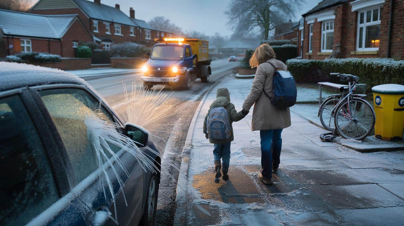
Here is when the frost may first bite and where.
Winter looks ready to jump the queue, with an early spell of wintry conditions flagged by the latest snow forecast. Forecast models point to a rapid north to south slide, putting parts of the UK on alert for icy mornings, slippery pavements and slow commutes. Families juggling the school run may feel it first, as roads turn greasy and windscreens glaze over.
The signal grows through mid November. Model guidance suggests bursts of snowfall in some regions, briefly intense in places, while lower ground further south tips back to rain. The headline rates sit at up to 5 cm per hour during the most active flurries in the east and centre. Confidence still ebbs and flows, yet the window for a first proper taste of winter has opened. So what next.
The dates snow could hit Scotland and sweep south
Forecast maps indicate the first flakes arriving across the far north of Scotland from 14 November. By early evening on that day, a broad swathe of the country could see a covering, with eastern and central counties flagged for the heaviest falls that may briefly reach up to 5 cm per hour. That would be the punchiest phase, and it may settle fast on higher routes while pavements turn slick at low levels.
After that initial push, the wintry zone edges south. On 15 November, forecasters expect snow across higher parts of Northern England, while Northern Ireland could see around 1 cm per hour for a time. Lower ground in southern England leans toward rain rather than snow during this phase, which still means messy roads and reduced visibility for early drivers.
Between 16 and 18 November, the Cairngorms hang on to wintry conditions with further snowfall keeping the Highlands white. Then another pulse arrives on 19 November, pushing light snow into Northern England, Wales, the Midlands and parts of the South Coast. Coastal towns could catch a dusting, while southern totals stay light with accumulations generally below 1 cm per hour. Guidance points to a clearance by 20 November, which would leave crunchy mornings and lingering patches of ice on untreated surfaces.
Met Office outlook points to colder snaps and frost
The Met Office keeps a cautious tone on widespread snow for now. For 11 to 20 November, it expects unsettled and generally mild weather with spells of rain and a chance of stronger winds, especially in western and southern areas. Calm and clearer nights may bring frost and fog for eastern and northern areas, so mornings could start with scraping and slow buses.
From mid November, there is potential for drier and cooler conditions that raise the odds of frosty starts and chillier mornings. Looking ahead to 21 November through 5 December, forecasters note a risk of snow at times. Confidence sits on the low side, while high pressure may deliver colder settled spells with fog, frost and hill snow in the north, along with average temperatures and brief colder snaps elsewhere.
Small steps families can take before the first flurry
Early snow does not always last, yet it can disrupt the basics. Icy starts, sudden showers and shiny footpaths can turn the school run into a slow shuffle. If you have a dog to walk or a car that sulks in the cold, a few simple checks will make mornings easier. And yes, dont leave the scraper buried in a drawer.
- Check winter coats still fit and that boots are waterproof, then line them up by the door for quick exits.
- Recharge de-icer spray and keep a scraper in the car, with a spare pair of gloves in the glovebox.
- Set alarms ten minutes earlier on flagged days to allow for icy pavements and slower traffic.
- Monitor travel updates during the evening and early morning so you can switch routes if needed.
The first wave from the north could bring that classic mix of sparkle and slush. Even if the southern half ends up with more rain than snow, the chill that follows often bites hardest on untreated roads and village lanes. That is when the quick prep pays off, from school shoes that grip to wipers that do not smear.
Winter appears to be getting a head start this year. Whether you relish the cosy factor or dread the frozen windscreen, the signals suggest the first flakes are close. Keep an eye on the forecast, plan the school run with a margin, and expect a few crisp mornings to bookend the week.